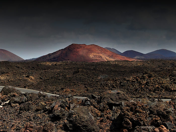
The Montañas del Fuego or Timanfaya Mountains are part of a vast area affected by the volcanic eruptions which took place in Lanzarote between 1730-1736 and, in 1824.This long period of eruptions which is one of the most historically relevant and spectacular on Earth, changed the morphology of the island drastically as it left a quarter of it buried under a thick layer of lava and ash.
The landscape created by volcanic activity comprises a total area of 174 Km² however, the region where the most significant eruptions occurred and currently designated as a national park, covers an area of 51 Km².
This original volcanic landscape remains virtually unaltered today and is a true research laboratory for the colonisation processes of fauna and flora. Thanks to these exceptional volcanic features, Timanfaya was declared a national park in 1974, the only geological one of its kind in the Spanish Network of National Parks.
César Manriques artistic legacy can be seen in the El Diablo restaurant in the Montañas del Fuego Mountains. This construction built in 1970, consists of a circular floor with glass walls which illuminate the interior and offer a panoramic view of the volcanic landscape. In the interior of the national park there is a 14km stretch called Ruta de los Volcanes which can only be accessed by bus. The road, created by Jesús Soto, which has been constructed in harmony with its surroundings, winds through the heart of the eruptions where unique elements of geological and geomorphologic interest converge.
The extreme fragility of the environment made it necessary to create a tour which would enable its beauty and magnitude to be enjoyed without spoiling it. Timanfaya is visited by almost a million people annually, and it is one of the most visited national parks in Spain along with the Cañadas del Teide National Park.
![]()
© 2015 Autos Cabrera Medina. All rights reserved


